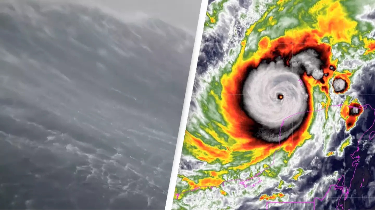
The wind speed of Hurricane Milton has caused a wave to rise to a height of a whopping 28.12 feet.
Less than a fortnight after Hurricane Helene hit, Hurricane Milton has followed swiftly in its path.
If you get sea sick, you should probably look away.
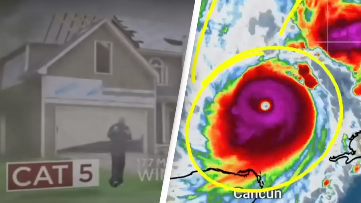
By the time it made landfall in Florida yesterday (October 9), the storm was classified as category three, stated as consisting of ‘winds [going at] 111-129 mph (96-112 kt or 178-208 km/hr)’ where ‘devastating damage will occur’.
“Well-built framed homes may incur major damage or removal of roof decking and gable ends. Many trees will be snapped or uprooted, blocking numerous roads. Electricity and water will be unavailable for several days to weeks after the storm passes,” the Saffir-Simpson scale states.
And it was yesterday when Hurricane Milton was at a category three when a drone managed to capture the storm’s effects on an area of sea in the Gulf of Mexico, ’40 nautical miles from the center of the storm’.
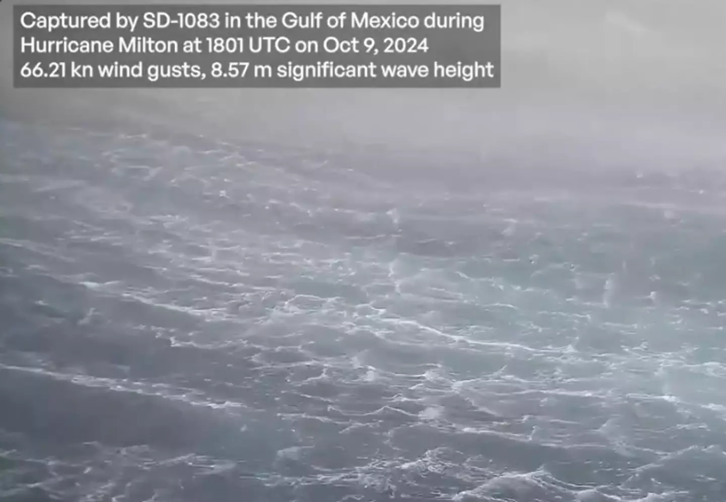
The footage was taken 40 nautical miles from the center of the hurricane (Twitter/ @NOAA_AOML)
NOAA Atlantic Oceanographic and Meteorological Lab and Saildrone captured footage of the impact of the storm on the waves, reporting Hurricane Milton’s wind gusts were measuring ‘as strong as 75.95 mph’.
NOAA Atlantic Oceanographic and Meteorological Lab shared the clip to Twitter, explaining: “This research represents a collaborative endeavor to better understand the role of the ocean in hurricanes.”
And the footage is enough to make even the most sea-experienced among us queasy, it not taking long for people to flood to the post to weigh in.
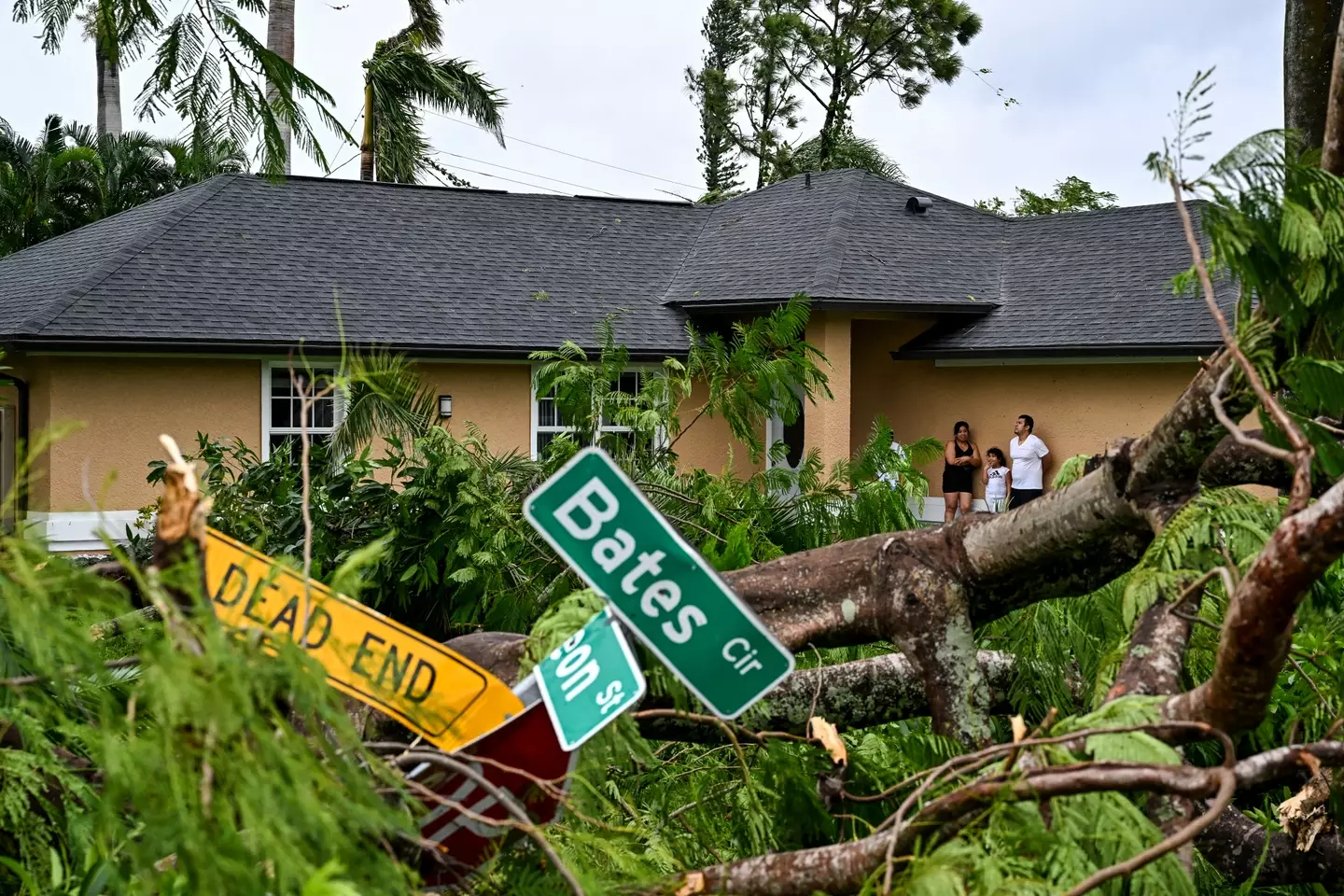
Damage caused by Hurricane Milton (CHANDAN KHANNA/AFP via Getty Images)
A Twitter user said: “Wow.”
“Wtf 28ft tall wave?!” another added.
A third commented: “I’m getting seasick from seeing this.”
“Pretty cool that one of these lil guys is out there, capturing data, doing his job, weathering one of the biggest storms and helping ppl understand whats comjng. Thanks Saildrone and NOAA!!” a fourth wrote.
A fifth said: “Love the fact an UNmanned craft can go into dangerous places and study the effects and science of things we still need to study.”
And a sixth said: “This is insane! Be safe, Florida!”
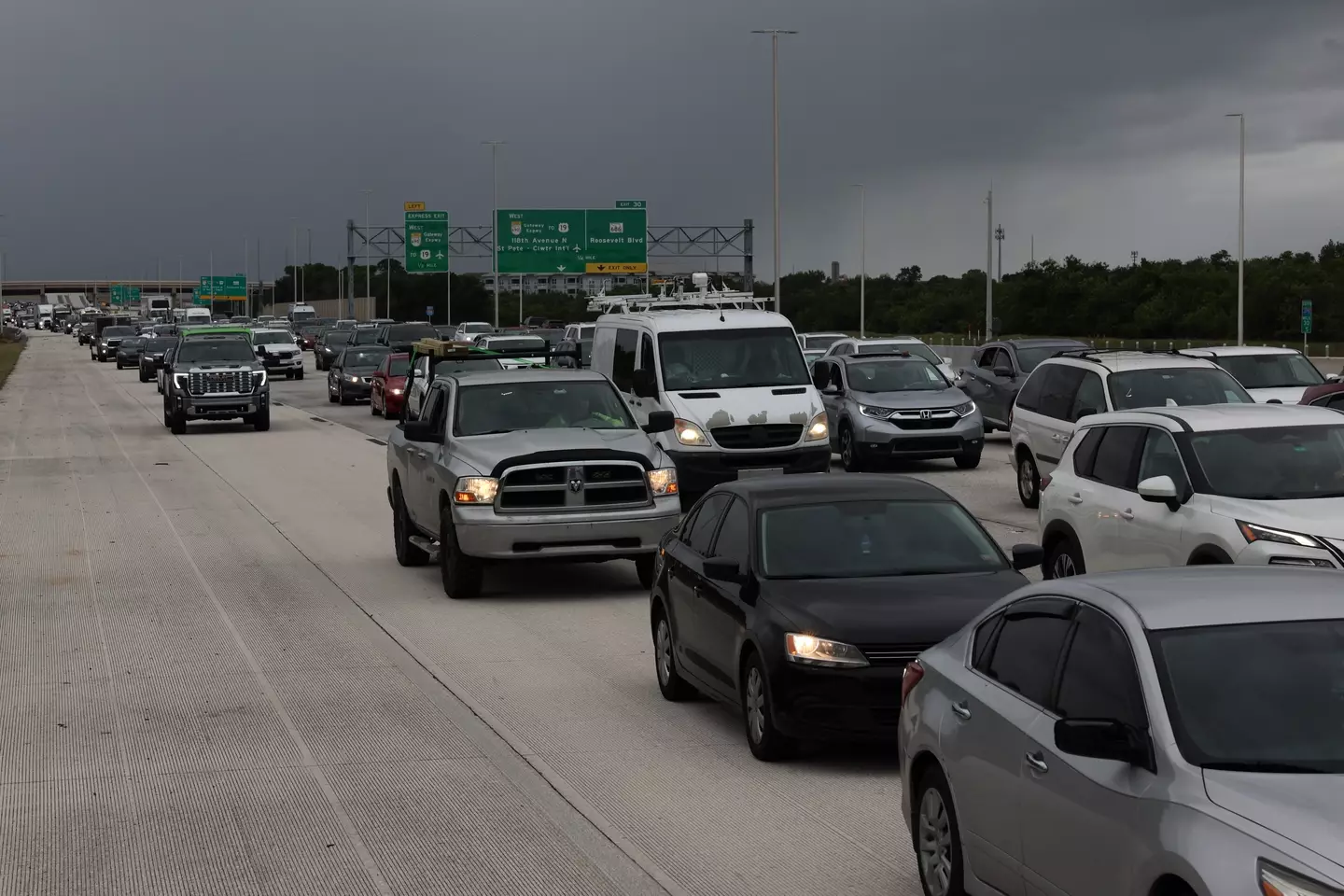
Florida residents have been urged to evacuate with NWS Tampa Bay warning residents to treat the extreme winds ‘as if a tornado was approaching’.
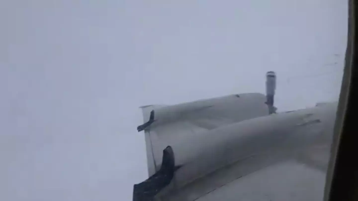
But that doesn’t stop the brave folks who study the weather in the US from doing just that, as terrifying footage shows.
Such operations are frequently carried out by the organisation to carry out scientific research directly from the centre of severe weather.
Aircrafts will collect data to help improve the forecast for the storm as well as inform our knowledge about hurricanes for the future.
The planes are effectively a mobile weather station and can take all manner of readings right from the midst of the action.
NOAA Aircraft Operations Center public affairs specialist Jonathan Shannon told the New York Post: “Our NOAA WP-3D Orion aircraft have been flying into storms for almost 50 years.”
No thank you (X / @NAOO_HurrHunter / NOAA Aircraft Operations Center)
Shannon explained that the flights are important as scientists ‘cannot get this important data our forecasters need at this scale and resolution any other way.’
He added: “We basically take a weather station to the weather.”
As for the actual experience of flying itself, needless to say it makes the average turbulence on a commercial flight look like a walk in the park in comparison.
Shannon said: “The best analogy I’ve heard is it is like riding an old wooden roller coaster through a car wash.”
Nonetheless, the crew on board this flight were all calm as they collected their data as their plane was buffeted about by the storm.
The video shows inside the aircraft, with things being tossed about inside the cabin.

The team were cool and collected in the cabin (X / @NAOO_HurrHunter / NOAA Aircraft Operations Center)
It was shot by Programs Integration Engineer Nick Underwood, who can be heard to ask “Can you grab my phone real quick?”
He added: “When you get a chance, can you grab my wallet too? Gotta keep these pockets zipped!”
The video was tweeted out by the NOAA Aircraft Operations Center with the caption: “Bumpy ride into Hurricane #Milton on @NOAA WP-3D Orion #NOAA43 “Miss Piggy” to collect data to help improve the forecast and support hurricane research.”
People were left impressed by the team’s dedication to helping predict the weather.
One wrote: “It has always been amazing to me that we have planes that can safety fly into and through the strongest and most turbulent parts of the strongest hurricanes.”
Another wrote: “Impressive work by the pilots and crews on board!”
A third said what many of us might be thinking, joking: “I am no longer nervous about commercial turbulence.”
Currently barreling toward the Florida Peninsula, Hurricane Milton recently regained its Category 5 strength earlier this evening as millions evacuate expected vulnerable areas and prepare for the incoming storm.
As the National Hurricane Center announced that storm surges are expected to occur along parts of Florida’s west coast tomorrow, The Weather Channel released a simulation earlier today anticipating what the surge might look like in the Tampa Bay Area where storm surges are expected to hit ‘a record-setting surge over 9 feet’.
Using FloodFX simulation technology, The Weather Channel’s meteorologist Stephanie Abrams demonstrated what a 9 feet surge will look like in the Tampa Bay Area.
Florida residents have been evacuating (Spencer Platt/Getty Images)
As animated water rose behind her, Abrams explained: “At 3 feet above normally dry ground, water is already life-threatening. It’s too late to evacuate.
“Water this high can knock you off your feet, make cars float, and driving impossible. The first floor of homes and businesses are flooded.
“Unfortunately the water is expected to rise even higher at 6 feet, above the height of most people. Vehicles get carried away, structures start to fail,” Abrams continued.
“Anything can be in this water, sharp glass, debris, chemicals as well.”
Users on Twitter described the simulation as ‘terrifying,’ with some urging local residents to evacuate if they haven’t already.
“Flood simulation to show how high the storm surge from Hurricane Milton could get. This is a wake up call to leave if you haven’t already,” one user wrote.
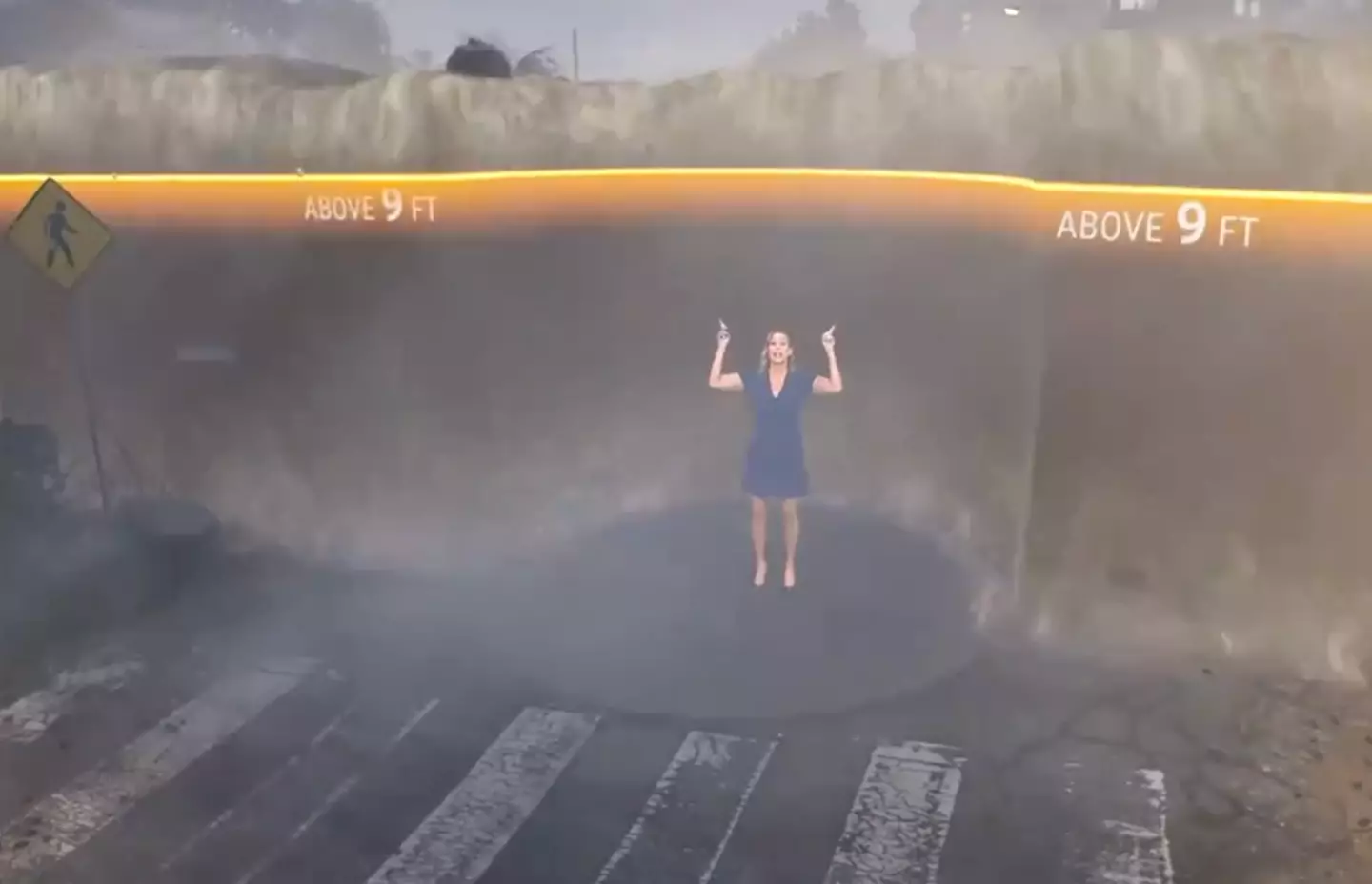
The simulation captures what a 9 foot surge looks like (Twitter/The Weather Channel)
“I got claustrophobic just watching it,” another added.
Another noted, “That visualization is showing static water, no movement. The surge will have 9 foot swells and water levels with FORCE.”
To donate to the American Red Cross, which helps provide food, supplies, shelter and emotional support to victims of crisis you can donate here.
Hot on the heels of Hurricane Helene – a category five hurricane – Hurricane Milton is set to hit parts of Florida today (October 9).
The hurricane could pose a risk to people’s lives.
As per the US Navy’s website, a category 5 hurricane is defined as: “Winds greater than 155 mph. Damage as above plus complete failure of roofs on may residential and industrial buildings. Extensive shattering of window and door glass.”
It goes on: “Many complete building failures and small buildings overturned or blown away. Storm Surge grater than 18′ above normal tidal levels. Low lying escape routes inland cut by rising water 12 to 13 hours before hurricane center arrival. Massive evacuation of residential areas on low grounds within 5 to 10 miles of shore possibly required.”
With the severity of the hurricane in mind, a simulation was created to demonstrate the devastating impact Hurricane Milton may have on people’s homes.
With a category one hurricane, according to the simulation, strong winds can cause tiles from people’s homes to fly off.
As the categories intensify, the impact worsens and by category three, the door of the home in the simulation has is blown into the property and the roof of the house ‘starts to flap up and down in the wind’.
Fast forward to category five and part of the roof has been completely destroyed causing its internal walls to fall down because they’re not attached to anything anymore, and all the trees in the neighborhood will have been uprooted.
The bleak simulation was first posted by The Weather Channel on YouTube 11 years ago, but has been doing the rounds again online ahead of the expected destruction Hurricane Milton’s expected to cause.
With this in mind, people on Twitter are urging Florida residents to evacuate their homes.
“Please, I’m asking my fellow Floridians to evacuate or seek shelter by this evening,” one person who shared the simulation penned yesterday.
.png)
People are being urged to leave their homes to flee the hurricane (Twitter)
“Evacuate Florida. No property or possessions are worth your life,” echoed another.
Elsewhere someone else described category five hurricanes as ‘biblical’.
They wrote: “As a person who’s dealt with hurricanes my whole life a category three & up are very serious. Category 5 is biblical in the damage it may do.
“Imagine a weak tornado but it hitting you for hours straight. Thats a hurricane. Prolonged winds, & rain for hours sometimes days.”
To donate to the American Red Cross, which helps provide food, supplies, shelter and emotional support to victims of crisis you can donate here.
Caroline Calloway took to social media to share her ill-advised plan to stay put as Hurricane Milton, which has been described as the ‘storm of a century’, continues to loom over Florida.
Millions of people have already evacuated the state on the advice of officials, but Calloway claimed she’d previously had a bad experience with evacuation and was hesitant to leave again.

Caroline said she’s in a mandatory evacuation zone (Instagram/@carolinecalloway)
In a video shared on Tuesday (October 8) and cited by The New York Post, Calloway said: “So if you’ve been following Hurricane Milton, um, I’m going to die.
“It’s supposed to make landfall in the Sarasota-Bradenton area. I’m in Sarasota, I live on the water. It’s a zone A, mandatory evacuation.”
Calloway, who has been dubbed the ‘world’s worst influencer’ and described as being a ‘scammer’, pointed to her inability to drive and the closure of the airport as two of the reasons she was not leaving her home.
She added: “Third of all, the last time I evacuated for a hurricane, I went to my mom’s house in Northport for Hurricane Ian …
“Her whole street flooded and we were evacuated after three days without power or running water by the US military.
“It was very traumatic and so I don’t want to evacuate to my mom’s house because the last time I did that, it was the worst time ever!”
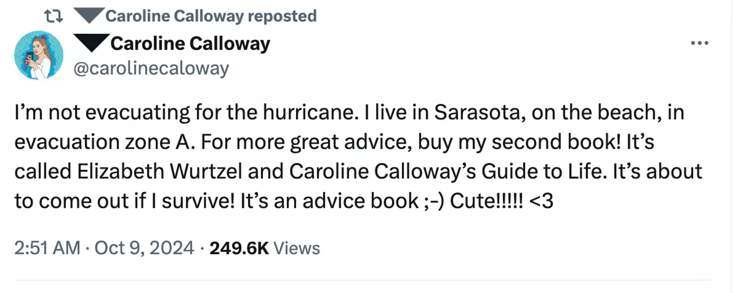
Caroline used the hurricane to help promote her book (X/@carolinecaloway)
Calloway assured she had food and water at her home, but admitted the situation was ‘kind of scary’.
“I’ll keep you guys updated,” she said.
Her decision comes as the mayor of Tampa, Jane Castor, issued a chilling warning to those considering staying put during the storm.
She said: “If you are in a single-story home that is hit by a 15ft storm surge, which means that water comes in immediately, there’s nowhere to go. So if you’re in it, basically that’s the coffin that you’re in.”
Calloway’s decision to stay at home has sparked controversy online, with many Twitter users urging her to get out while she still can.
One person wrote: “Caroline, i don’t know you, and what i have heard hasn’t been particularly good, so i need you to trust me when i tell you that you need to put your things in the first bag you find IMMEDIATELY, get in a car, and drive inland as FAST as you can. this is not a joke please be fr??”
Hurricane Milton is expected to hit the Tampa area today (October 9), with winds of up to 165mph (270km/h).